
SOLD OUT

St Lawrence East / Morristown to Massena Waterproof Chart WP-78A 11/24/2025 THIS CHART IS SOLD OUT 11/24/2025
SKU:
WP-78A
St Lawrence East / Morristown to Massena Waterproof Chart WP78A
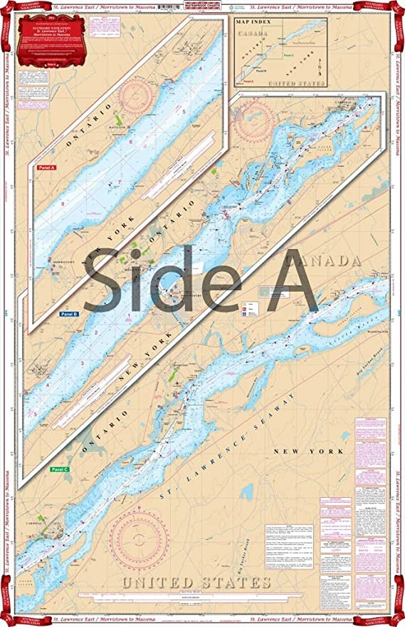
This chart covers the St Lawrence Seaway. Area includes Morristown on side A and continues east to Ogdensburg, Galop, Iroquois, and Ogden Islands.
Side B starts at Morrisburg and continues east to Ault and Croil Islands, past Massena to Barnhart Island and the Moses-Saunders Power Dam. Many Anchorages and Marinas and speed zones are listed. See adjoining chart #78 if you want full coverage from Wolfe Island to Morristown.
Nautical Chart is 25″ X 38″
"11/24/2025 THIS CHART IS SOLD OUT 11/24/2025"
OTHER PRODUCT
Other Product Picked For You


Sold out
Sale


Sold out
Sale


Sold out
Sale

Sold out
Sale

Sold out
Sale

Sold out
Sale
Sold out
Sale
Sold out
Sale

Sold out
Sale
