

New York Harbor to Block Island WP-02E Large Print 10/28/2025 THIS PART IS IN STOCK 10/28/2025
SKU:
WP-2E
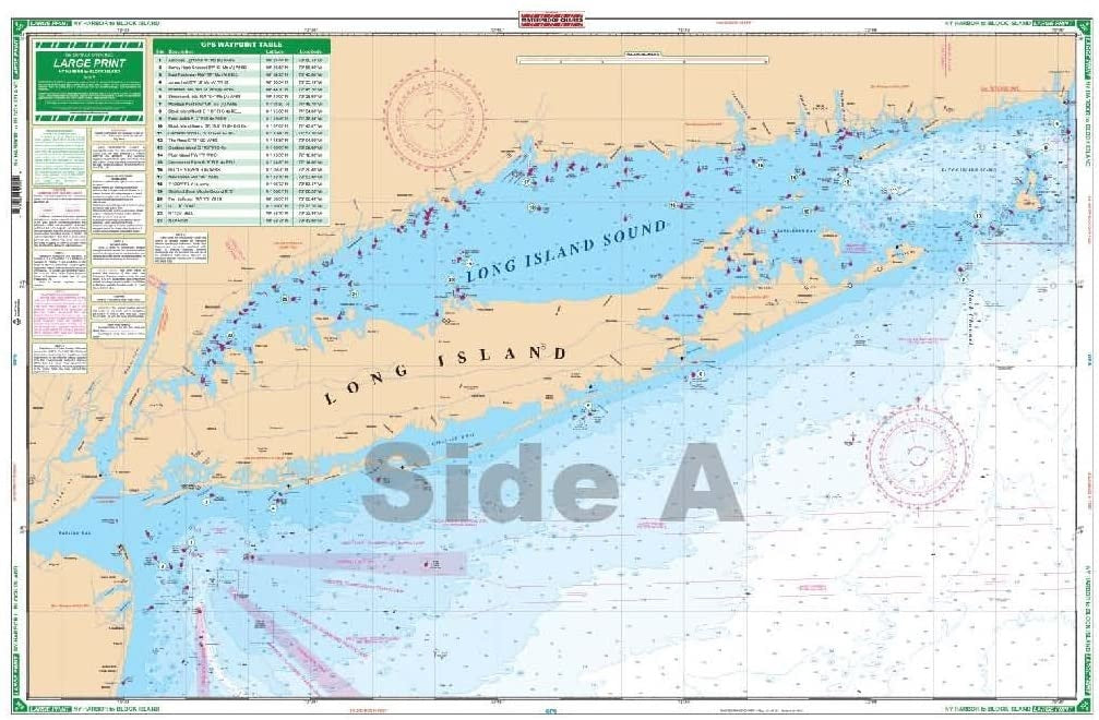
New York Harbor to Block Island WP2E Large Print
This Large print chart provides excellent coverage from the North Jersey Shore’s Shark River Inlet, Raritan Bay and New York Harbor east, covering all of Long Island and the Hampton Bays and the entire Connecticut Shore. This chart also covers Long Island Sound, Fishers Island Sound, and Block Island Sound.
- Latitude and longitude lines make it very easy to use with your GPS.
- 35 Waypoints are pre-plotted.
- The reverse side includes complete detailed coverage for Block Island.
- Information from 9 different government charts.
- Nautical chart is 25″ X 38″
- 10/28/2025 THIS PART IS IN STOCK 10/28/2025
OTHER PRODUCT
Other Product Picked For You


Sold out
Sale


Sold out
Sale


Sold out
Sale

Sold out
Sale

Sold out
Sale

Sold out
Sale
Sold out
Sale
Sold out
Sale

Sold out
Sale
