

New York Harbor Waterproof Chart WP-62 10/28/2025 THIS PART IS IN STOCK 10/28/2025
SKU:
WP-62
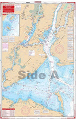
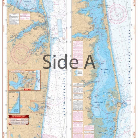
New York Harbor (Manhattan) Waterproof Chart WP62
The best chart for the New York City area combining information from five government charts. This navigational chart covers Sandy Hook Bay, the entire Lower Bay and Raritan Bay, Staten Island, Brooklyn, Jersey City, Newark, and lower Manhattan on one side.
The reverse side covers the East River through Hell Gate and out past Riker’s Island, under the Throgs Neck Bridge to Kings Point, as well as the Harlem River north to the Hudson.
Colored key and panel designations and large print place names make this chart easy to use. Five NOAA Charts: #12342, #12366, #12327, #12334 and #12339. Nautical Chart is 25″ X 38″
10/28/2025 THIS PART IS IN STOCK 10/28/2025
OTHER PRODUCT
Other Product Picked For You


Sold out
Sale


Sold out
Sale


Sold out
Sale

Sold out
Sale

Sold out
Sale

Sold out
Sale
Sold out
Sale
Sold out
Sale

Sold out
Sale
